C and O Canal
Background
The early colonists of the Virginia Company who had settled on the east coast of the USA had been ordered to try and find a 'North-West Passage' to the Pacific Ocean. While exploring the Potomac River with this in mind they discovered the rich Ohio Valley beyond the Appalachian Mountains to the west. Companies were set up to exploit the trade potential of the valley by providing transport systems to the coast. The barriers they had to overcome were the mountains and a series of rocky waterfalls in the Potomac River. Two alternative transport schemes were built, one being a canal from the Chesapeake Bay to the Ohio Valley (the C and O Canal) and the other being a railway line from Baltimore to the Ohio Valley (the B and O Railway). Both schemes followed the Potomac River west into the hills.'
The towpath is now the C & O Canal National Historical Park and is used by walking and cycling enthusiasts. This record was made as I explored it on my bicycle.
Mile 0 to Mile 15
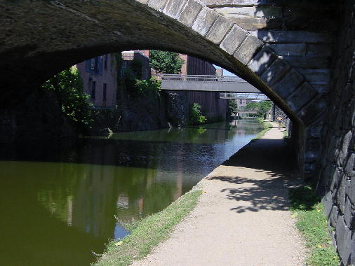
22 July 2001Mile 0 of the canal is in Georgetown, an affluent suburb of Washington DC. Where there are now quiet tree-lined streets and brick houses, there was once a grimy, booming commercial area of wharfs, foundries and mills. The trail starts near the tide lock, the place where boats locked into the canal from the Potomac River.
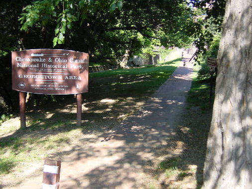
The canal starts its journey inland with a rapid climb through four locks in a distance of a few city blocks. Buildings alongside it show little trace of their trade years - the foundry is now upmarket apartments, a C & O staff office is a residence and a small brick building houses the ranger station for the C & O National Park. Some mules appear on weekends to pull a longboat up the canal.
The canal path is fairly narrow to start with, so cyclists, joggers and walkers all slow to a sedate pace to let each other pass. Brick-faced buildings give a hint of their early history as wharf-front stores.
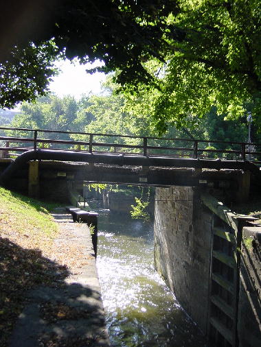
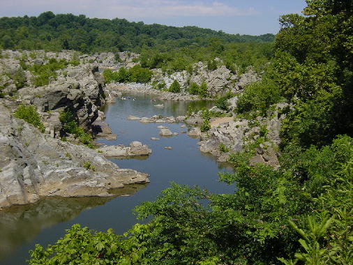
By about Mile 13 the canal has climbed high above the Potomac. Loops of the river bypass flood channels where canoeists practice their rolling and self-righting skills. The Great Falls just upriver was one of the reasons the canal system was needed.
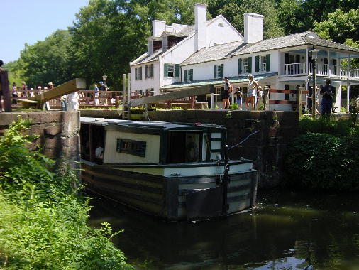
Along the canal route are occasional small buildings which once housed the lock-keepers and their families. At Mile 15 is a larger, more imposing residence, the Great Falls Tavern. This site is accessible by car and bus and many people visit the house, canal boat and falls. Folk in period costume talk of the canal and show how to a get a long, skinny boat through a lock.
Touring: Mile 184.5 to Mile 4
September 2001Rob got us into gear by forcing the issue. He booked a U-Haul truck so we could get our bikes to Cumberland where we could drop it at a depot, and he planned each day's distance and booked the accommodation for us. Left to ourselves we would have just dreamed about cycling the length of the canal path while sitting by a winter fire. Thanks for getting us going Rob.
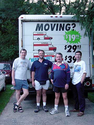
A Friday night saw us gathered in Washington, DC, loading our cycles and gear into the truck, having our tea then departing into the growing dusk. Four across on a three seater bench seat - a bit of a squeeze. However, we persevered and later that night rolled into Cumberland and the Holiday Inn parking lot. We checked in and that was that for the night - apart from a small amount of celebrating the start of our trek.
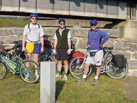
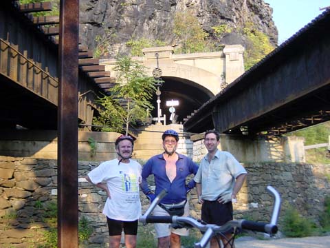
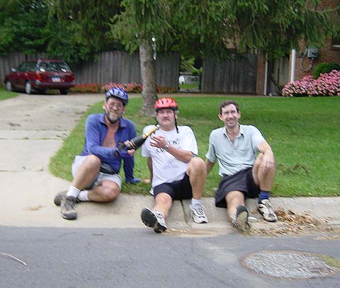
The next morning we arose, breakfasted (MacDonalds) and refuelled the truck at a convenient garage. We then drove around in circles for a while looking for the drop-off point. It turned out to be the garage we had refuelled at. Sigh, not a good sign. The truck was unpacked, we loaded up our bikes and peddled a short half mile to the start of the trail. A brilliant fine day, though we knew a storm front was coming through which might catch us on the end of our third day. But that was for later. We took time out for a compulsory group photo at the mile 184.5 marker post.
Well, we took off like startled rabbits. That crazy pace lasted for a mile or two then we settled down and got on with a steady mile-eating pedaling rate. Even so, we were using a lot of energy for what was a comfortable flat trail on which the only hills were small downward ones at the occasional lock.
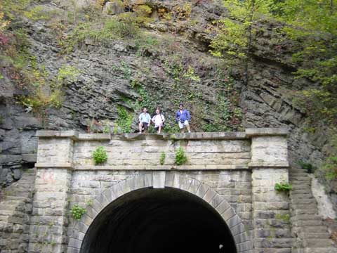
The trail was very pretty and it was often like this - a long green tunnel of slow curves and long straights. It did have occasional exciting moments such as Paw Paw Tunnel (compulsory photo op) at Mile155 and the subsequent missing Lock 65 at Mile 154 (which was not needed and was never built.)
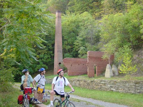
Just below Mile 128 we came across a series of kiln arches in the hillside, a brick chimney and some brick walls. This was the remnants of the Round Top Cement Mill which provided much of the cement used in the construction of the upper part of the canal. In its heyday it had four pairs of grindstones, each five feet in diameter which were driven by a 16 foot diameter overshot waterwheel. The crushed lime was burnt (coal for the kilns came up the canal by boat) and the resultant cement went either down the canal (where it was used in such projects as the Washington Monument and the US Capitol) or was pulled across the river on an overhead wire to the B and O Railroad which had been laid on that side of the river.
As dusk neared there was an increase in wildlife activity and we saw five whitetail deer on the trail. We eventually pulled into Hancock at Mile 124 a bit later than expected and found our accommodation. We also found the other occupants of the motel were dressed as southern gentry - belles and gentlemen in high heeled cowboy boots and string ties.
We took stock of our situation that evening and realised we were not going to make the end of the trail in our current state. We were all overloaded and while my New York knee was OK, it was under a lot of strain. Brian also had concerns about an old war wound to one of his knees and decided not to push himself any further. We debated our options and eventually decided to carry on, but with a much reduced gear load which we would send off with Brian and his transport which would come up from Washington.
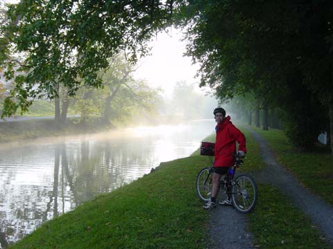
The following morning we were all creaking at the seams. Our ride yesterday had included a late start and we had covered a slow 60 miles. This day we started an hour earlier and had 65 miles to cover, but with lighter loads. We were optimistic we could do it in reasonable time so we waved goodbye to Brian and set off into the morning mist.
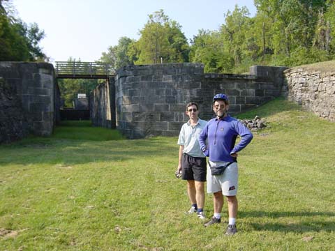
At one point we found that the canal swung away from the river and cut across a neck of land before rejoining it at a series of locks (Mile 108) which made this possible. As we approached the locks a groundhog bustled across the dry bottom and disappeared into his hole in the wall. We stopped at the locks to get a feel for the scale of the work involved. These locks were close to being destroyed by the same workers who had made them. The canal company had run short of funds and the workers had not been paid so they seized 140 casks of gunpowder and threatened to blow the lot up. The state militia had refused to intervene as they too were owed wages for previous work. A compromise was eventually reached and the situation was defused, so to speak.
By 11.30 we reached Mile 99 at Williamsport and turned across the earth bank into the parking area for a rest. To our surprise we saw Brian and his transport crew walking towards us. They had just arrived and had called in to look up and down the track.
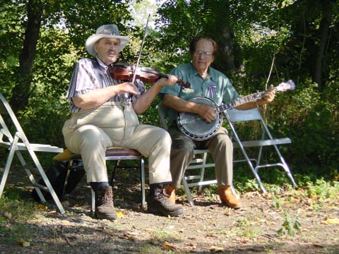
We stopped there for an hour, had lunch and chatted. We were also serenaded for some reason which I never fathomed. Under the trees two gents were plucking out some barnyard music on fiddle and banjo. We had been kidding each other during the day about what to do if we heard some 'Deliverance' type banjo music in the remote woodland tracts and here we were getting it in the town! Eventually we mounted up, said goodbye to the gang and carried on our journey.
A wearing grind eventually got as down to Mile 60 and Harpers Ferry. Here the Shenandoah and Potomac Rivers merge, the States of Virginia, West Virginia and Maryland come together, and John Brown's soul went marching on. By the time we crossed the river on the pedestrian walk of the railway bridge, it was 6 PM and the town was closing its historic doors for the night. A National Park Ranger (in period costume) gave us some tips for easier riding to our accommodation and a suggested restaurant to feed in. Our last short pedal for the day took us through the town and up onto a local highway. Here we walked a few short metres of the Appalachian Trail as it crossed the road with us, then left it as it became a goat track again. We checked in, fed, then collapsed into bed and slept the sleep of the just.
The morning of our third and last day dawned foggy and cool. We were still aware of the cold front and thunderstorms scheduled for the afternoon, and wanted to reach town in time to meet a school bus and to greet youngsters arriving home. We started our day yet another hour earlier and were on the road by 7.30. We were getting into the 'grit and determination' stage of the tour and were now just ticking off miles rather than enjoying the country around us. Every three miles we would stop and walk for a few minutes to relieve saddle sores.
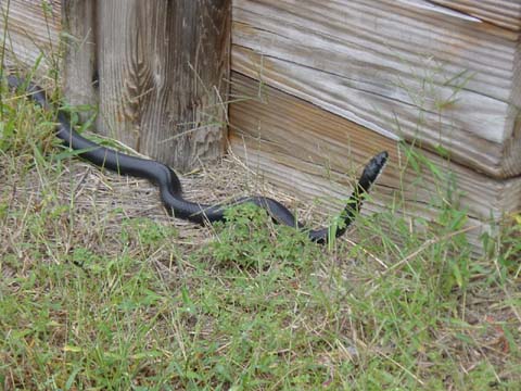
We had a bit of excitement at Mile 42 where an aqueduct crossed the Monocacy River. Down on the dry canal bed we spotted a black snake peering into nooks and crannies. I hopped down into the bed of the canal - not with any agility by this time - and went over to take its picture. With a zoom lens the snake looked quite large and it was probably a little late to wonder about how fast snakes can move, or would one attack a creaky cyclist. I was told it was a black rat snake, so hoped that ruled out cyclists.
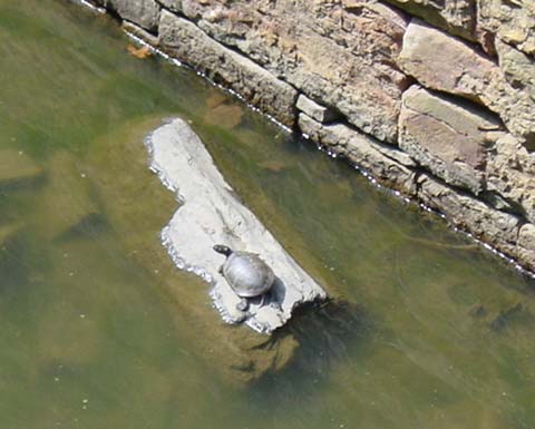
We found more wildlife a little further on in the form of a generously sized turtle which had come out to bask in the sun. Our early start had also allowed us to surprise a few more deer on the canal path at the start of the day.
Just before Mile 15 we got a few spots of rain and a warning that the front was due through soon. We had a short breather at Great Falls, then knuckled down to the last stretch, basically we were running on empty. We eventually reached Mile 4 and the railway bridge which carries the Crescent Trail cycle path up into Bethesda, our goal. On that trail we ground our way up what was probably quite a gentle incline until it peaked and we left it to wind our way around a few streets and to reach our goal.
Using a great degree of forethought, Paul had stowed a bottle of Lindaer Special Reserve in the fridge before we had left. We had timed things just right as we had arrived in time to meet the kids off the school bus and were congratulating ourselves as raindrops began to fall heavily a few minutes after our arrival.
Our smug attitude began to evaporate as the TV channel showed pictures of 'rotating wall clouds' until their rooftop camera got zapped by a lightning blast. The TV doppler radar then showed us that the cloud had dropped a tornado in the area of Mile 0 of the canal path, about where we would have been had we continued on! The tornado moved north and overturned a truck on the beltway, picked up a car with two college students in it and flipped them over an 8 story building killing them both, then carried on north up the road towards my home. It gradually dissipated and become just high winds and drenching rain mixed with thunder and lightning.
When things had calmed down a bit, Rob and I headed off for Baltimore, passing the flipped truck on the beltway and a mess of iron roofing tiles and shattered trees. We didn't say a lot on that drive, but we were quite grateful that we had ended our cycle ride when we had.
While there was a lot of physical effort involved in our tour, I am pleased to have done it. We met many delightful people along the way but missed many sites that are worth returning to, such as historic Fort Frederick of the French and Indian war years and the Antietam National Battlefield. I am also itching to spending time on the Appalachian Trail. So many things to do. Sigh.